

Ausangate Trek Map: Passes, Lakes and Campsites
The Ausangate trek follows high Andean trails around the base of Ausangate (about 6,384 m), crossing three passes between 4,850 and 4,980 m, passing turquoise lakes, and camping at Upis, Pucacocha, and Queullacocha before finishing at Rainbow Mountain (5,036 m). The route changes slightly between our four treks, so this guide lists the stops in order, with altitudes, to help you read any map of the circuit.
Ausangate Trek Route in Order
This is the route of our 5-day Ausangate trek to Machu Picchu and our 4-day llama trek, which follow the same trail for the first four days. The 5-day trek then continues by road and train to Machu Picchu, while the llama trek returns to Cusco.
| Day | Stop | Type | Altitude |
|---|---|---|---|
| 1 | Upis camp | Campsite, hot springs | 4,400 m (14,435 ft) |
| 1 | Upis Lake | Side trip, 2 hours round trip | 4,500 m (14,763 ft) |
| 2 | Arapa Pass | Pass | 4,850 m (15,912 ft) |
| 2 | Pucacocha Lakes | Campsite | 4,600 m (15,091 ft) |
| 3 | Apacheta (Apuchata) Pass | Pass | 4,900 m (16,076 ft) |
| 3 | Ananta Valley | Lunch stop | 4,700 m (15,420 ft) |
| 3 | Warmisaya Pass | Pass, first view of Rainbow Mountain | 4,980 m (16,338 ft) |
| 3 | Queullacocha | Campsite | 4,850 m (15,912 ft) |
| 4 | Rainbow Mountain (Vinicunca) | Summit | 5,036 m (16,522 ft) |
| 4 | Red Valley | Viewpoint and trail | about 4,900 m |
| 4 | Final lunch spot | Road access | 4,200 m (13,780 ft) |
The trek starts near Upis, reached by road from Cusco via the town of Tinqui. The drive takes about two hours to Tinqui, followed by roughly 30 minutes more to the trailhead.
The Three Main Passes
Each pass is a high point on the route, and each comes with a steep climb and descent:
- Arapa Pass (4,850 m): About two hours of climbing from Upis on Day 2, followed by a gradual descent to the Pucacocha Lakes.
- Apacheta Pass (4,900 m): The first climb of Day 3, about two hours from camp, followed by a descent to the Ananta Valley for lunch.
- Warmisaya Pass (4,980 m): The highest pass on the route. It takes about 1.5 hours to climb from Ananta Valley, and the first view of Rainbow Mountain comes from the top.
Day 3 is the hardest on this route: about 12 km and 7 to 8 hours with two passes. Our Ausangate trekking guide gives more background on the mountain itself.

Lakes on the Ausangate Trek
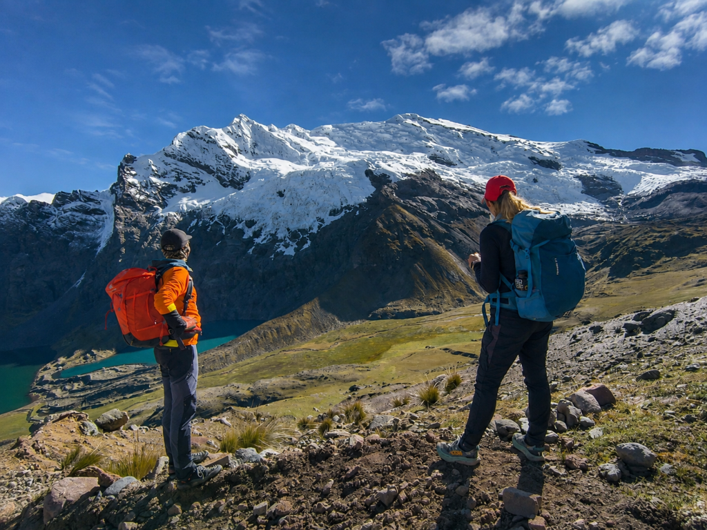
- Upis Lake (about 4,500 m): A short side trip from Upis camp on Day 1, and an easy way to test how you feel at altitude.
- Pucacocha Lakes (about 4,600 m): Turquoise lakes beside the Day 2 campsite. You spend the afternoon here after crossing Arapa Pass.
- Queullacocha (about 4,850 m): The Day 3 campsite, named for the lake there, and the highest camp on this route.
- Surineqocha Lake (about 4,800 m): The campsite for our 2-day Ausangate trek.
The Seven Lakes Loop
If you only have one day, the Ausangate 7 Lakes day hike is a 10 km loop of about 5 hours from Pacchanta (about 4,300 m), with a high point above 4,600 m. The lakes on that page are Otorongo Macho, Otorongo Hembra, Puca Cocha, Ccaomer Cocha, Alca Cocha, Catalina Cocha, and Patacocha. You finish with a soak in the Pacchanta hot springs.
A Note on Spelling
Place names vary across maps, signs, and guidebooks. You may see Pucacocha written as Puka Cocha, Apacheta as Apuchata, and Queullacocha as Queulla Ccocha or Qeullaqocha. They refer to the same places.
Campsites and Conditions
Camps sit between 4,400 and 4,850 m, so nights are cold. According to our Ausangate weather guide, which gives operator estimates rather than measured data, frost is common at Upis and nights often drop to around -10°C (14°F) at Anantapata, the coldest camp on the 4-day route to Machu Picchu.
| Camp | Altitude | Route | Notes |
|---|---|---|---|
| Surineqocha Lake | about 4,800 m | 2-day trek | Only night of the trek |
| Upis | 4,400 m | 5-day, llama trek, 4-day to Machu Picchu | Hot springs, frost common |
| Pucacocha Lakes | 4,600 m | 5-day, llama trek | Afternoon free by the lakes |
| Queullacocha | 4,850 m | 5-day, llama trek | Highest camp on the route |
| Anantapata | 4,700 to 4,750 m | 4-day to Machu Picchu | Coldest camp |
Camping gear is set up for you, with four-season tents, foam mats or inflatable pads, and a dining tent. You can rent a sleeping bag for $20, and we recommend one rated to at least -15°C (5°F). Our trekking equipment checklist has the rest of the packing list.


How the Four Routes Differ on the Map
| Route | Starts at | Camps | Ends at |
|---|---|---|---|
| 2-day trek | Quesiuno (4,376 m) | Surineqocha Lake | Chillihuani, then Cusco |
| 4-day llama trek | Upis | Upis, Pucacocha Lakes, Queullacocha | Rainbow Mountain, then Cusco |
| 4-day to Machu Picchu | Chillihuani (4,400 m) | Anantapata, Upis | Pacchanta, then Machu Picchu |
| 5-day to Machu Picchu | Upis | Upis, Pucacocha Lakes, Queullacocha | Red Valley, then Machu Picchu |
The 4-day Ausangate trek to Machu Picchu runs in a different order. You start at Chillihuani and reach Rainbow Mountain on Day 1, then camp at Anantapata (about 4,750 m). Day 2 crosses Pucacocha Pass (about 4,900 m), with lunch at Pucacocha Lake, before the camp at Upis. On Day 3 you descend past moraines to the Pacchanta hot springs, then transfer by road to Ollantaytambo and take the train to Aguas Calientes.
The trade-off is altitude. Reaching 5,036 m on Day 1 is demanding, while the 5-day and llama routes save Rainbow Mountain for Day 4. Our acclimatization guide recommends at least three full days in Cusco before any of these routes, and our altitude sickness guide explains the symptoms to watch for.
If you only want Rainbow Mountain, the Rainbow Mountain and Red Valley day tour and our Rainbow Mountain hiking guide cover that part of the map without camping.
What a Map Won’t Show You
A route map shows distances and altitudes, but not conditions on the trail. A few things to expect:
- Terrain: The paths include loose scree and steep ascents and descents, though no technical climbing.
- Timing at Rainbow Mountain: We aim to reach the summit around 6:30 AM on the 5-day and llama treks, ahead of the day-trip groups from Cusco, weather permitting.
- Snow and cloud: Snow is possible above about 4,800 m, especially from November to April, and cloud can hide the glacier and the colors of Rainbow Mountain.
- Support: Horses or llamas carry your duffel bag and camping gear, and an emergency horse travels with the group.
Frequently Asked Questions
It depends on the route. The 5-day and llama treks start near Upis, reached via Tinqui, about two hours from Cusco by road. The 2-day trek starts at Quesiuno, and the 4-day trek to Machu Picchu starts at Chillihuani.
Arapa Pass (4,850 m), Apacheta or Apuchata Pass (4,900 m), and Warmisaya Pass (4,980 m) on the 5-day and llama routes. The 4-day trek to Machu Picchu crosses Pucacocha Pass (about 4,900 m).
On the 5-day and llama routes, you camp at Upis (4,400 m), the Pucacocha Lakes (4,600 m), and Queullacocha (4,850 m). The 4-day trek to Machu Picchu camps at Anantapata and Upis, and the 2-day trek camps at Surineqocha Lake.
On the 5-day and llama treks, Rainbow Mountain (5,036 m) is the final highlight on Day 4. On the 4-day trek to Machu Picchu, you reach it on Day 1.
By the daily distances, the 5-day and llama treks cover about 38 km, the 4-day trek to Machu Picchu about 34 km, and the 2-day trek about 21 km. Most of the route stays above 4,000 m.